Winetech has appointed the Centre for Geographical Analysis (CGA) to develop a prototype online spatial decision support system (SDSS) for the wine industry. The project is being carried out in close collaboration with the Department of Viticulture and Oenology at Stellenbosch University.
The aim of the project is to develop and integrate a range of applicable spatial datasets at a vineyard scale and disseminate these datasets via a prototype online SDSS. The main purpose of the SDSS is to aid long-term (e.g. establishment of new vineyards) and seasonal decision-making (e.g. compliment phenology, canopy growth, ripening, yield development monitoring). The prototype is being developed for an 80x90km pilot area covering the Franschhoek, Elgin, Caledon and Robertson wine regions in the Western Cape.
The specific objectives of the project include the development of:
- Terrain maps at various (90m, 30m, 5m and 2m) resolutions;
- High-resolution (30m), hourly temperature surfaces for a period of three months (1 December 2016 – 28 February 2017;
- Two years (24 months) of interpolated layers of daily minimum, maximum and average temperature at a suitably high (e.g. 30m) resolution;
- A long-term, high-resolution climate database sufficient for both research and high-detail industry site selection decision-making;
- A prototype online SDSS platform, allowing for the display and layer selection of the developed climate products; elevation data and derivatives; as well as ancillary GIS information;
- Reporting functionality for the prototype online SDSS platform, allowing for the compilation of relevant mapped and tabulated information to be extracted per agricultural field.
The pilot study will consist of six phases, aligned with the six objectives.
Phase 1 comprises the generation of a range of terrain derivatives from several digital elevation models (DEMs), including the 5m-resolution Stellenbosch University Digital Elevation Model (SUDEM) and the newly-developed, 2m-resolution DEM of South Africa (DEMSA2).
Phase 2 involves the development of three months of high-resolution, hourly temperature surfaces, using supplied weather station data and the relevant terrain derivatives generated in Phase 1.
Phase 3 involves the development of two years (24 months) of high-resolution (suitable resolution to be determined), daily temperature statistics (minimum, maximum and average), using provided weather station data and the relevant terrain derivatives generated in Phase 1.
Phase 4 involves the development of 30-year climate surfaces (minimum, average and maximum temperature; relative humidity; and total monthly rainfall) at a suitable resolution (to be determined), using available weather station data.
Phase 5 comprises the development of a prototype online SDSS platform (web application). This web application can be found here: https://www.terraclim.co.za/.
Phase 6 involves the development of additional functionality for the web application. The functionality proposed for this phase will allow the user to generate a report per agricultural field. The report will include relevant tables and maps. The objective of this phase is to demonstrate the concept of report generation and to facilitate stakeholder engagement through which suggestions for further functionality will be gathered.
DEMSA2 derivatives:
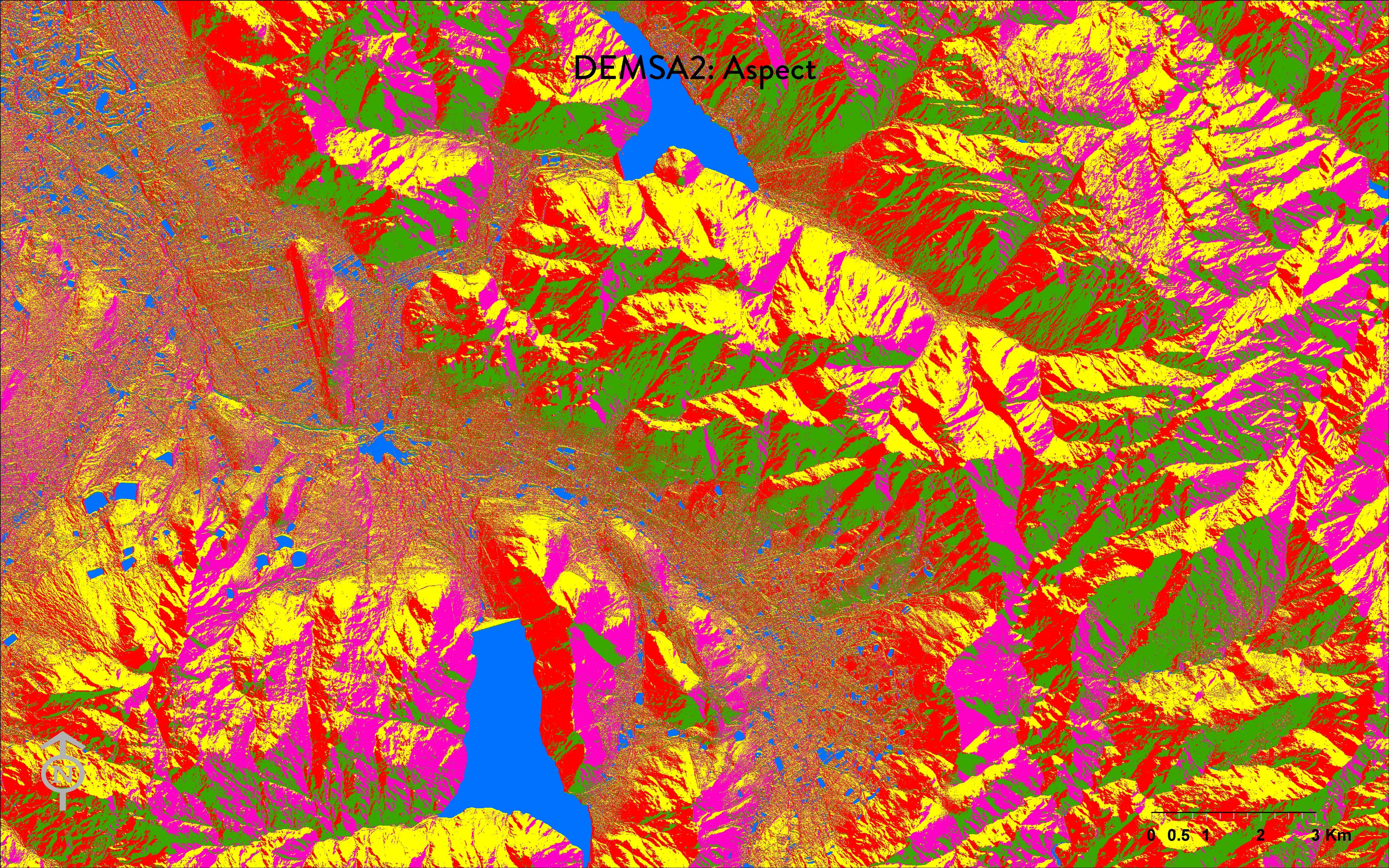
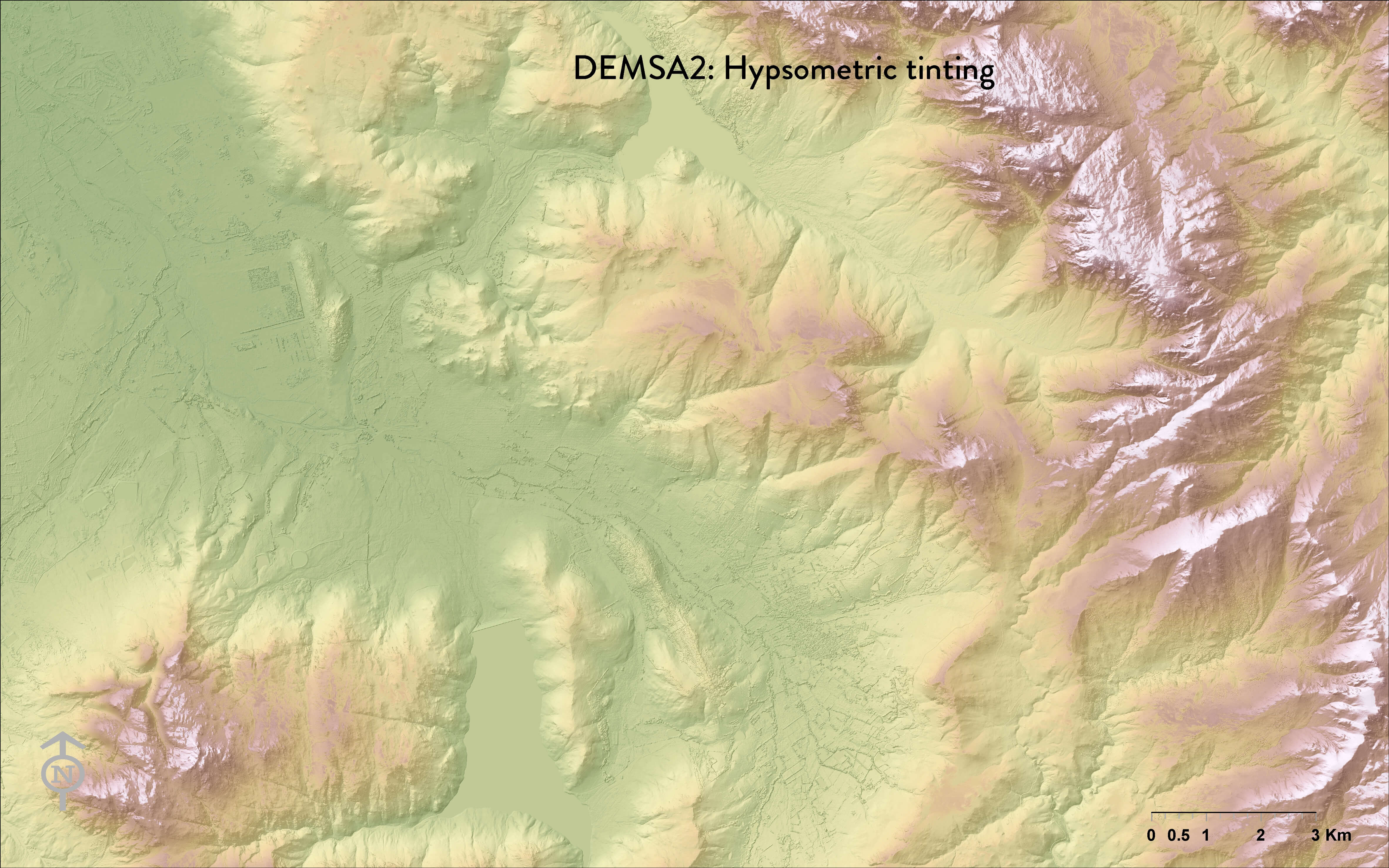
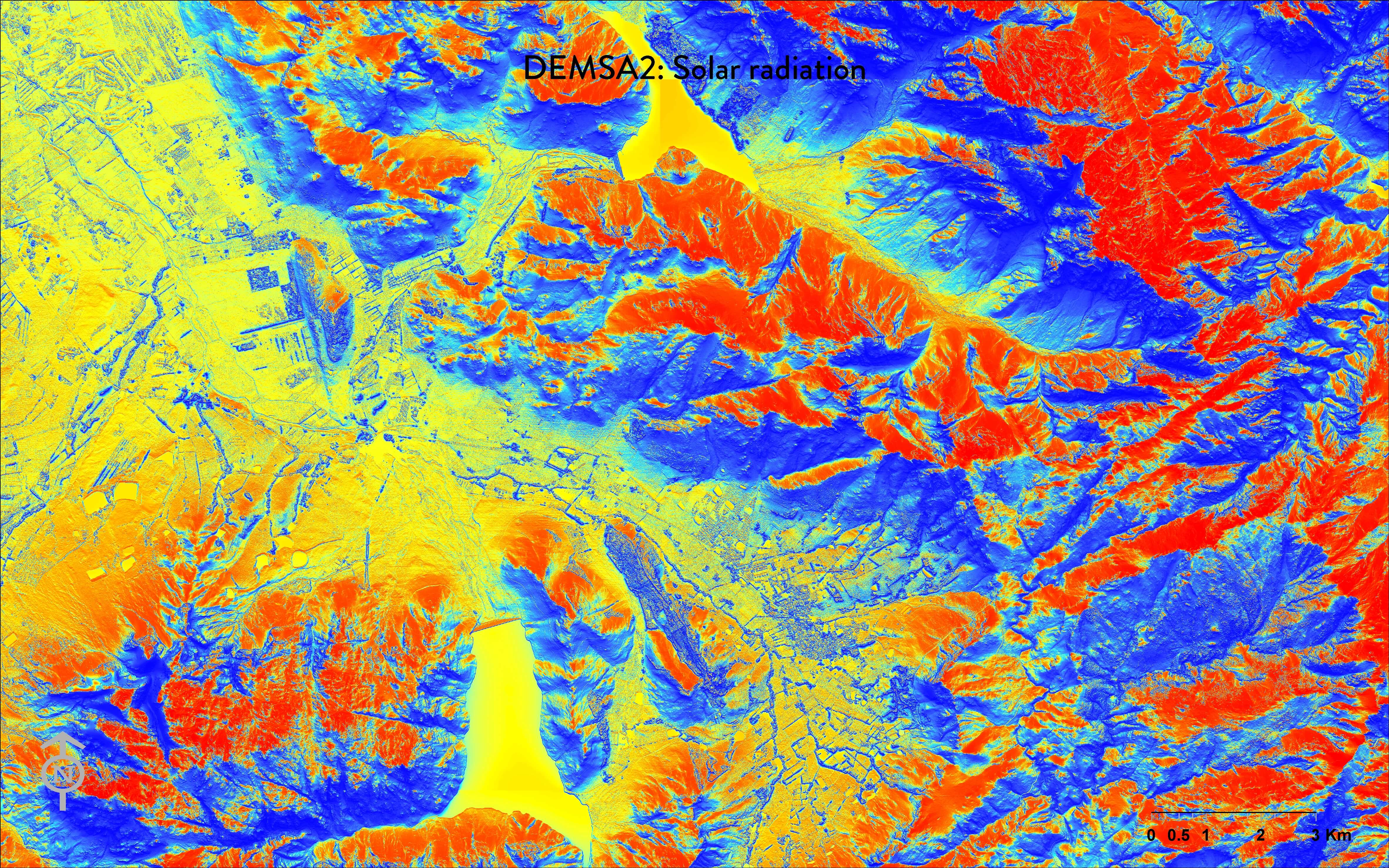
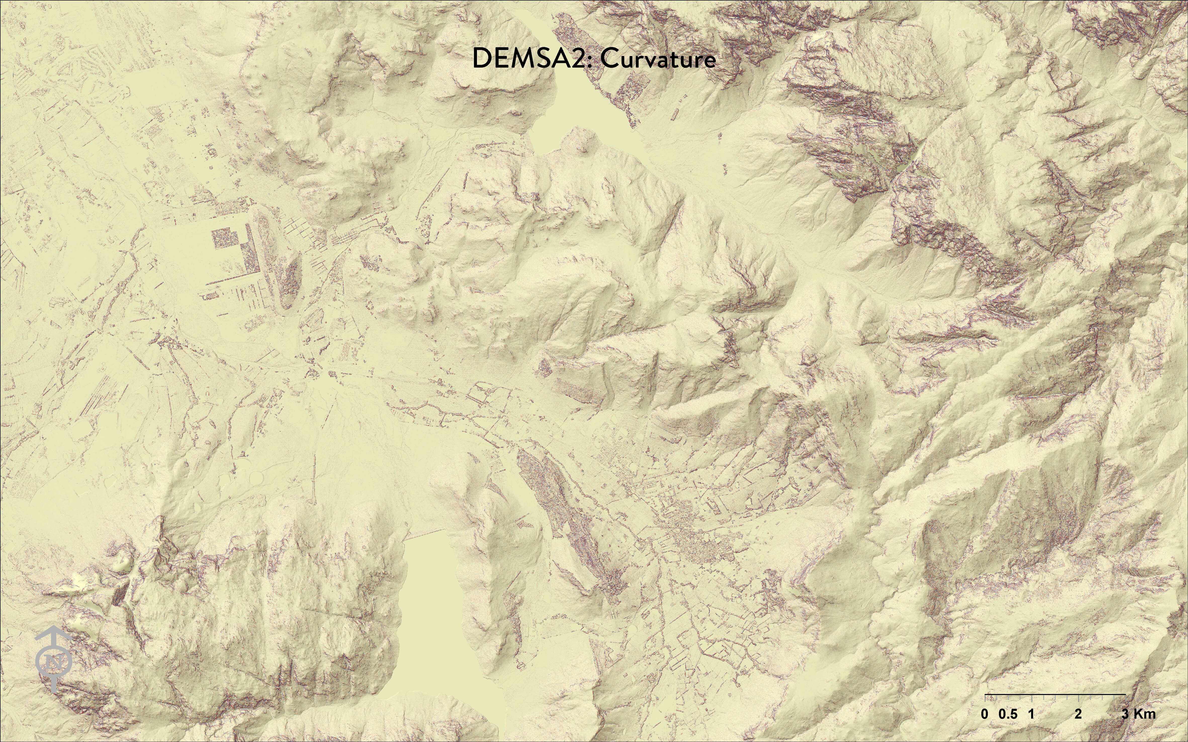
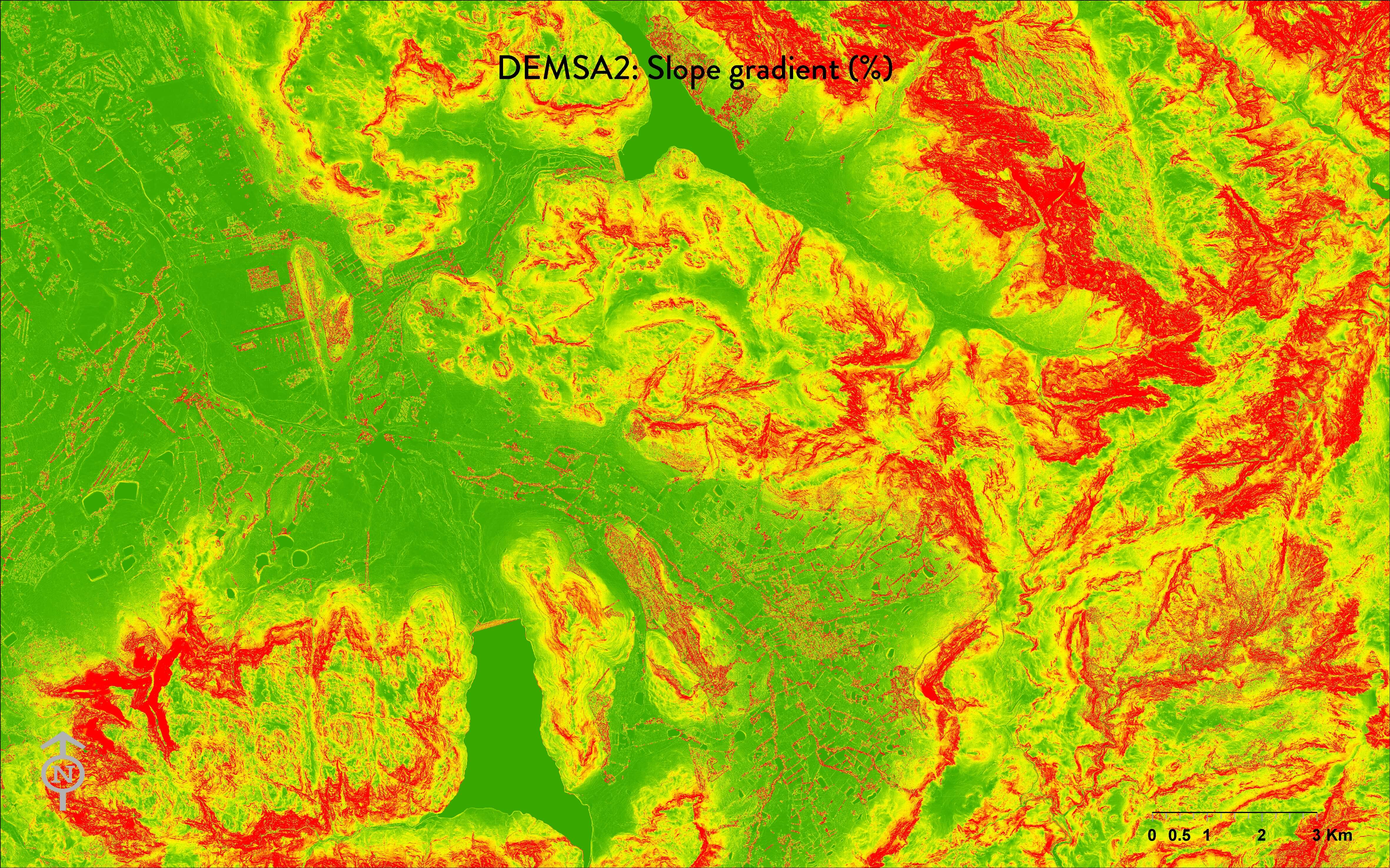
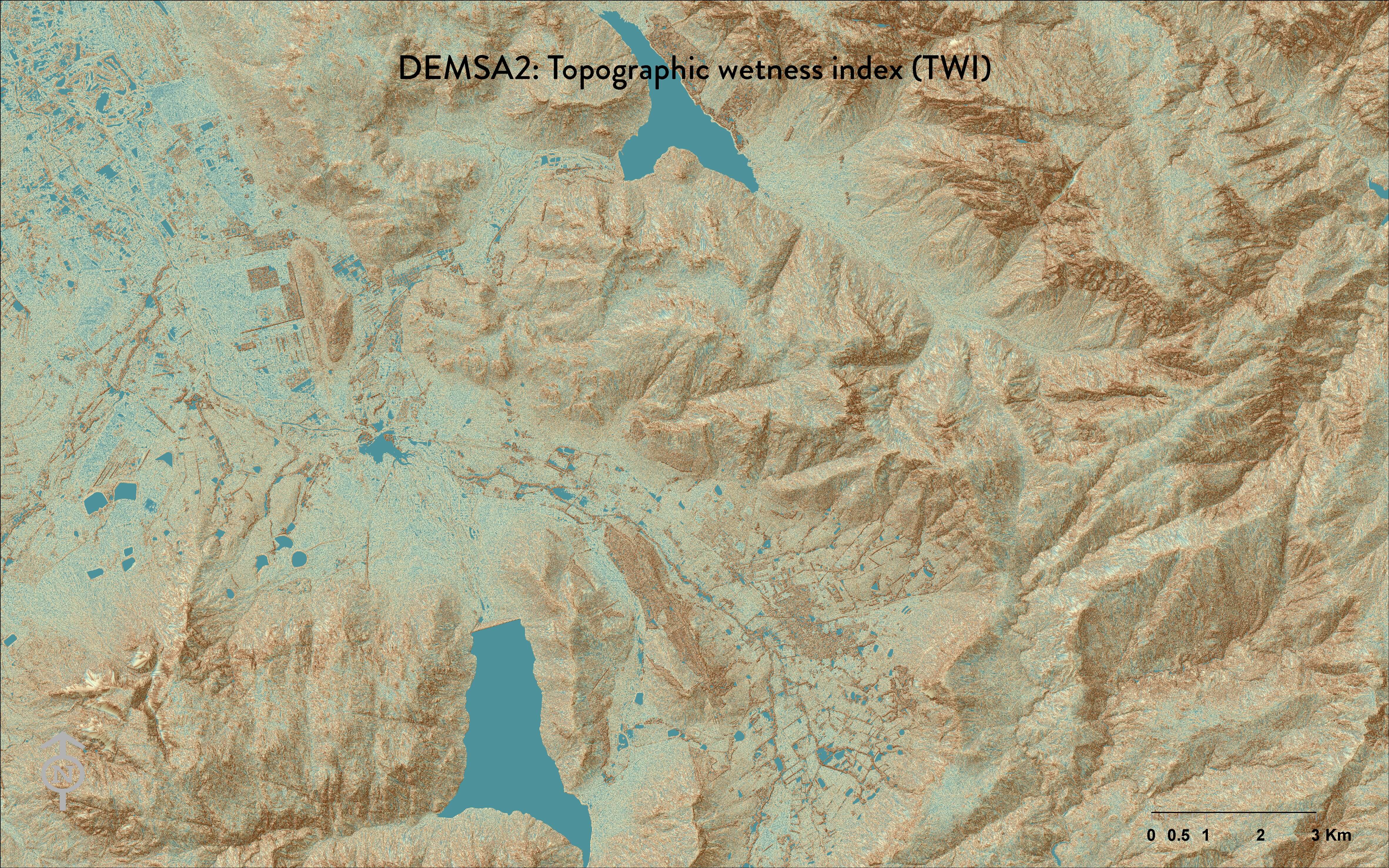
(Click on image to enlarge)