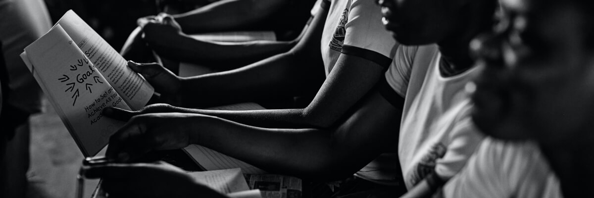
RESEP School Viewer
In 2021 the CGA assisted the Research on Socioeconomic Policy (RESEP) team in developing an interactive map called the RESEP School Viewer. This web-based tool toggles the data of learner flows at different grades and levels of the system - national, provincial, education districts and wards. It is available for public access and [...]
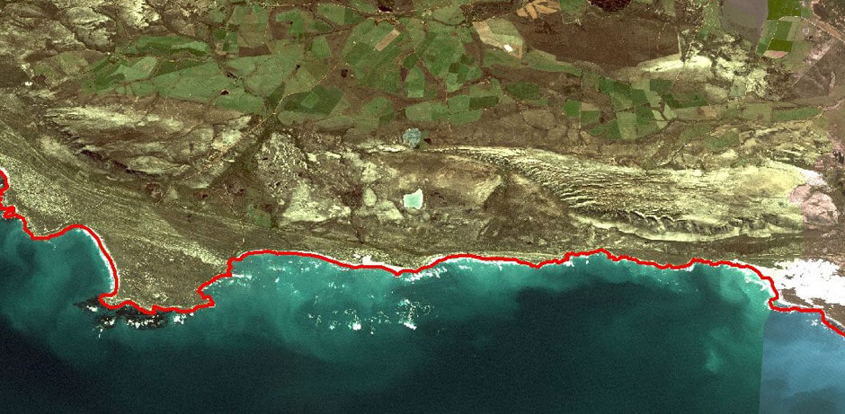
National Coastal Climate Change Vulnerability Assessment
Have you heard of the National Coastal Climate Change Vulnerability Assessment? South Africa has approximately 3000km of coast. Due to climate change, we are expecting sea levels to rise and more storms to hit, creating winds that result in severe flooding and erosion. Together with the CSIR, Stellenbosch University and Nelson Mandela University, [...]
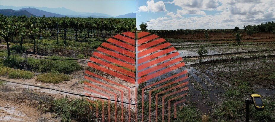
Inter-tree orchard analysis
Optimal production potential can only be achieved in a fruit orchard when every single tree is contributing efficiently. However, orchard variation is difficult to study as variation occurs over space and time and is often caused by multiple factors – including soil-, water-, nutrition- and pest-management, and climate and genetic variability. Led [...]
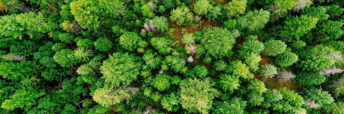
Plantation forest mapping and water use
Commercial plantations of introduced tree species provide most of the timber and fibre requirements of South Africa. However, not much is known about how much water is used for commercial forestry, how the water use varies among genera and regions, and how water used for commercial forestry compares with other competing land uses. [...]
SALT ACCUMULATION AND WATERLOGGING MONITORING SYSTEM (SAWMS) DEVELOPMENT
This project, undertaken for the Water Research Commission (WRC) of South Africa, builds on research conducted for the WRC in the Quantification of Salt Accumulation of Water Logging in Irrigation Schemes project of 2013-2016. Specifically, the aim of the project is to develop a system that automatically analyses multi-temporal satellite imagery for [...]
STELLENBOSCH MUNICIPALITY LAND AUDIT PHASE 1
In September 2016, Stellenbosch Municipality and the Centre for Geographical Analysis (CGA) at Stellenbosch University embarked on a collaborative effort to share GIS data and services. As part of this collaboration, a comprehensive land audit for all properties within the Stellenbosch Municipal Area will be carried out. Phase 1 of this [...]
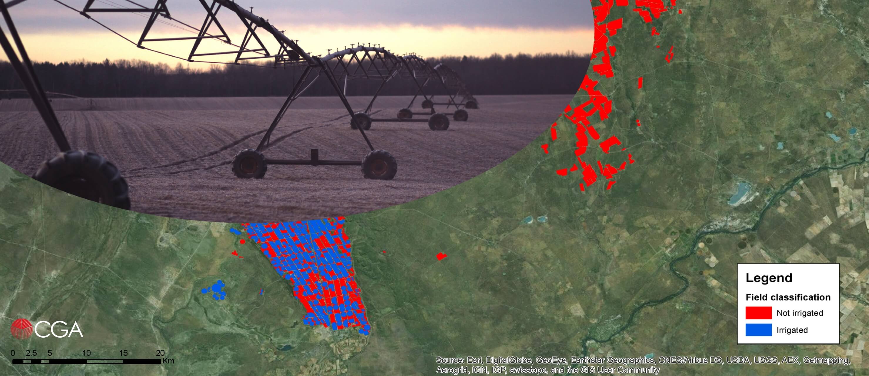
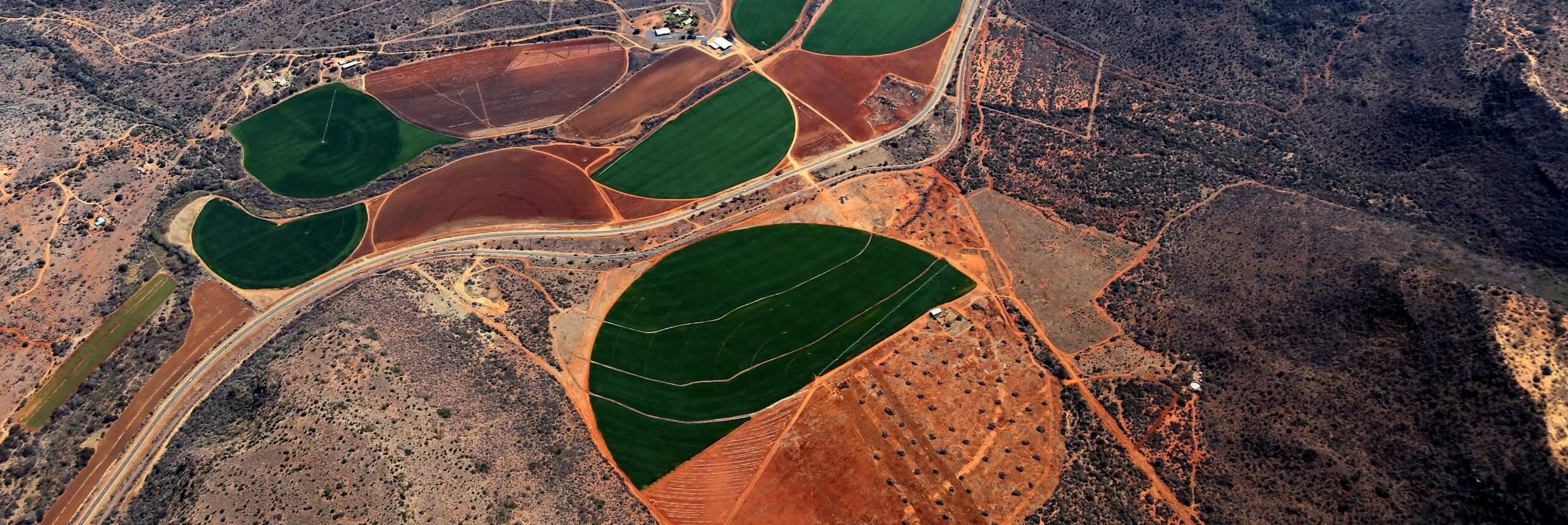
WIDE-SCALE MODELLING OF WATER USE AND WATER AVAILABILITY WITH EARTH OBSERVATION/SATELLITE IMAGERY
This project, undertaken in collaboration with GeoTerraImage and eLEAF of the Netherlands for the Water Research Commission (WRC) of South Africa, aims to update the existing estimations of the amount of water used by irrigated agriculture in South Africa. This is being done by employing various EO and GIS techniques, including the [...]
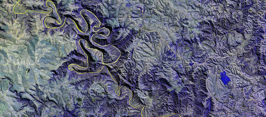
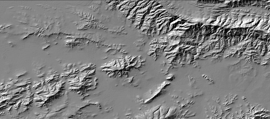
Terrain Analysis
Terrain analysis is defined as the study of the nature, origin, morphological history and composition of land forms, the result of which is a land form or land component map. Land components can be mapped by studying topographical maps, interpreting aerial photographs (Speight, 1977) and making field measurements (Graff and Usery, 1993). Such [...]
Cartography
Cartography is the art and science of representing natural or anthropogenic features on a flat surface. As mapmakers, we understand that a map must be designed with attention to the audience and its needs and that the goal of a map is to assist the reader to discern its purpose promptly and effectively. The CGA [...]
Data capturing
Data capturing includes the collection or creation of spatial information for use in geospatial representation or analysis. Data capturing performed by the CGA can include tablet or on-screen digitising, scanning, manual database entry, field-work collection, and a wide variety of spatial data acquisition. Data capturing performed by the CGA can include tablet or [...]
Geocomputation
GeoComputation involves geographical (spatial) analysis and modelling and typically includes the development of methods to model and solve a range of highly complex, often non-deterministic problems. The aim is to provide enabling technologies for quantitative geographical analyses and to overcome associated computational challenges. The CGA is actively involved in this field [...]
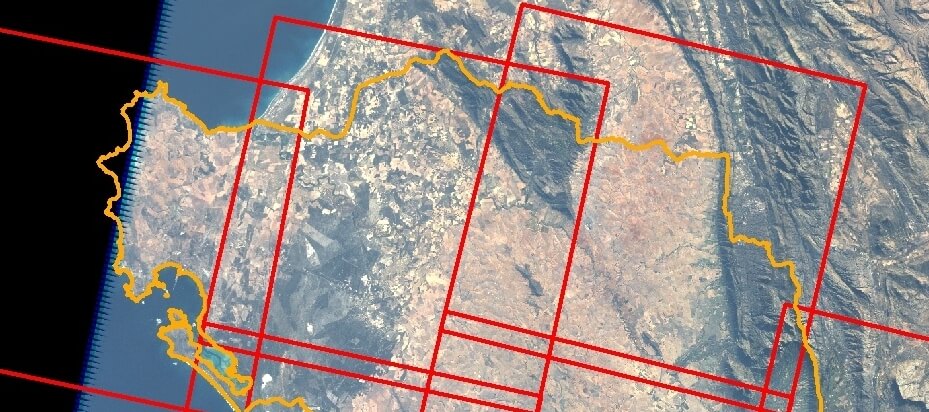
Orthorectification
Orthorectification is the process of geolocation and terrain distortion correction of aerial or satellite imagery. Depending on the nature of the imagery, this process can involve the matching of identifiable points on the ground to their corresponding points on an image, often making use of specific camera calibration variables, aeroplane/satellite position and orientation [...]
Web Mapping Applications
Geographical Information Systems (GIS) has revolutionized geographic analysis and spatial decision support and has greatly enhanced our understanding of the real word though it’s mapping and spatial modelling capabilities. Although GIS software is becoming more powerful, less expensive and more user-friendly, GIS still remains the domain of a selected few who can operate [...]
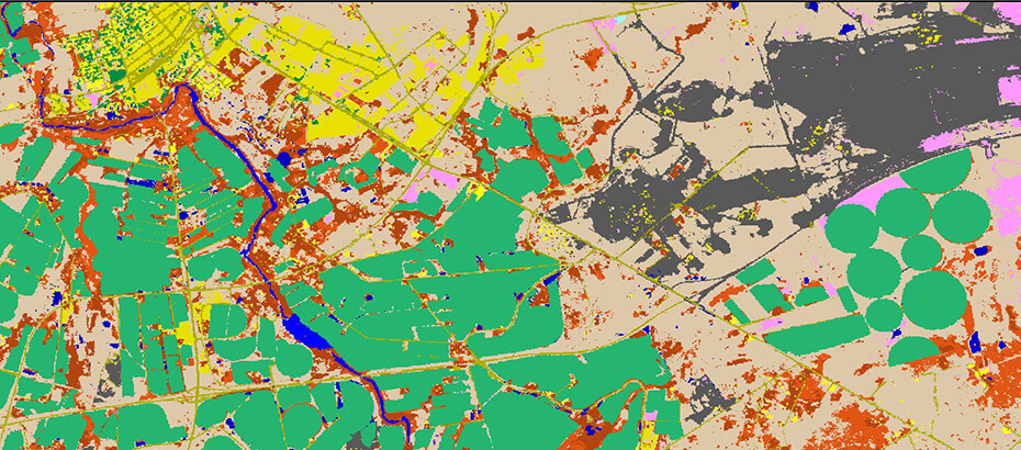
Land Cover Mapping
For geographical information to be most effective in decision making it must be detailed, up-to-date and accurate (Benz et al. 2004; Carvalho et al. 2004). This also applies to land cover data, which is essential for decisions related to land evaluation (Kalogirou 2002; Van Niekerk 2008), urban and regional planning (Tapiador & Casanova [...]
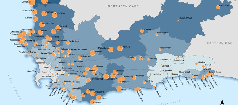
Growth Potential Study of Towns
One of the objectives of the Department of Environmental Affairs and Development Planning (DEA&DP) of the Western Cape provincial government is to undertake spatial planning that promotes and guides the sustainable future development of the province and redresses spatial inequalities. This goal led to the development of the Provincial Spatial Development Framework (PSDF), [...]
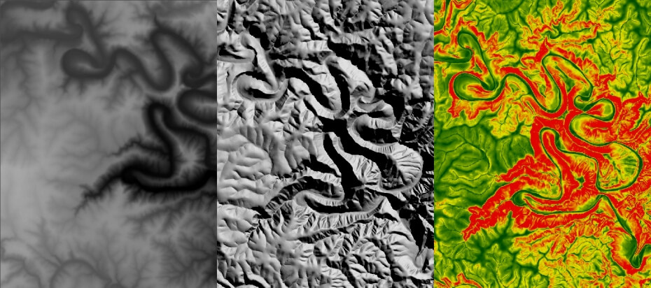
SUDEM – Digital Elevation Model Development
In an effort to address the need for a high-resolution digital elevation model (DEM) of the Western Cape, the Centre for Geographical Analysis (CGA) developed and released the Western Cape Digital Elevation Model (WCDEM) in 2001 (Van Niekerk, 2001). The WCDEM was interpolated from 1:50000 scale (20m vertical interval) contours using the [...]
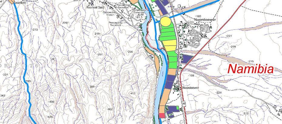
Quantification of Salt Accumulation and Water Logging in Irrigation Schemes
This research project, initiated by the Water Research Commission (WRC) of South Africa, is experimental in nature. Various techniques are applied and compared to empirical (reference) data to determine their potential for monitoring and quantifying water logging and salt accumulation. The large scope of this project includes 9 major irrigation schemes in [...]
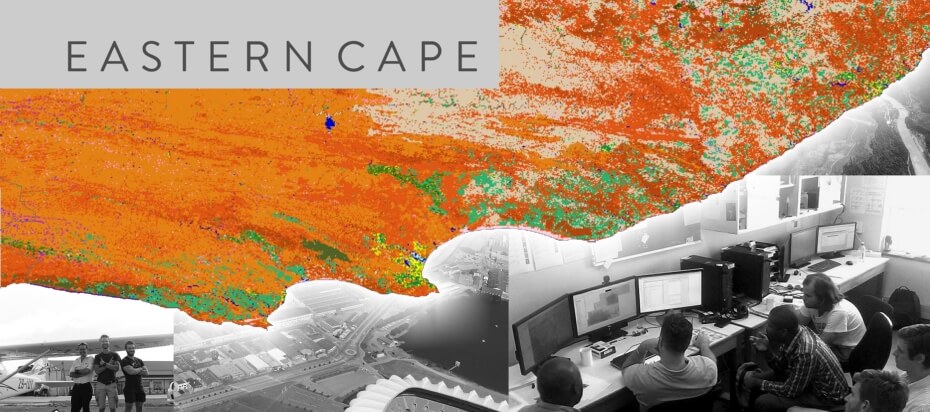
Eastern Cape Land Cover 2015
The land cover mapping project for four areas of the Eastern Cape (Rietbron, Nieu-Bethesda, Burgersdorp and Cradock) is now in the final stages of field verification and error correction. The project will be completed towards the end of March. For more about CGA land cover projects see our completed project or click [...]