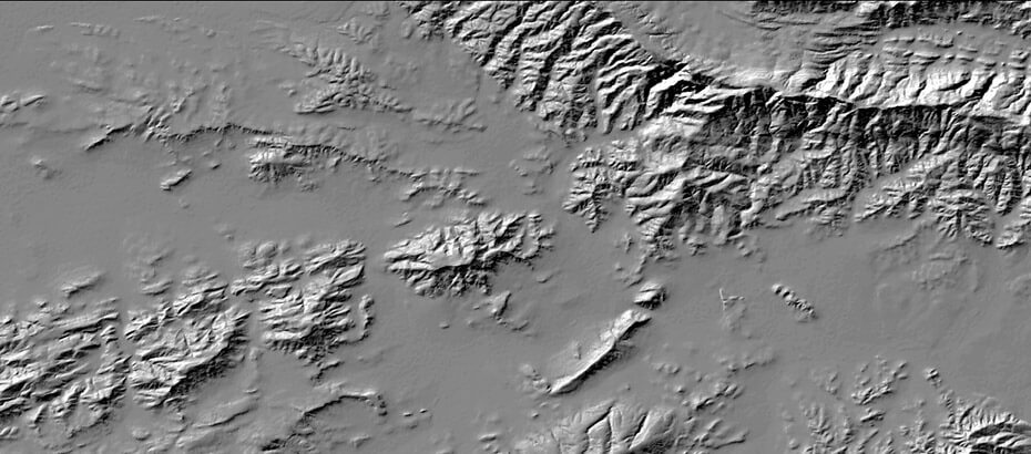
In an effort to address the need for a high-resolution digital elevation model (DEM) of the Western Cape, the Centre for Geographical Analysis (CGA) developed and released the Western Cape Digital Elevation Model (WCDEM) in 2001 (Van Niekerk, 2001). The WCDEM was interpolated from 1:50000 scale (20m vertical interval) contours using the ANUDEM algorithm (Australian National University, 2011). Notwithstanding subsequent releases of other DEM covering the Western Cape (e.g. SRTM and GDEM), the WCDEM still remains the DEM-of-choice for many applications. This is mainly due to its relatively high spatial resolution, consistency and accuracy. Since the release of the WCDEM, many users have expressed an interest in a similar DEM covering South Africa. The CGA also receives frequent requests for more detailed (i.e. larger-scaled) DEM and have produced many very high resolution (<20m) DEM from 1:10000 scaled contour data (where available) and stereographic aerial and satellite imagery.
The idea of combining various sources of elevation data into a single national DEM was, consequently, a logical progression. Experiments showed, however, that incorporating various sources (and scales) of elevation data into existing interpolation algorithms often produce unsatisfactory results. Examples include visible “seams” at transition zones between differently-scaled sources, artefacts as a result of inconsistencies between data sources, and grid-like “textures” due to the fusion of data with different sampling resolutions.
Another major obstacle in the development of a national DEM was the many attribute and spatial errors that occur in the available digitized contours and spot heights. Attribute errors can have a significant effect on the resulting DEM, as even a 5m offset can significantly alter the terrain characteristics of an area. In some cases these errors are large enough to identify using normal visualization methods (e.g. hillshade, slope, aspect, curvature and other focal operations), but in most cases the errors are in the order of one or two contour intervals and are not easily noticeable. An automated method was consequently developed to detect and correct even the slightest error. In addition, a methodology was developed to fuse elevation data from different sources and scales so that “edge effects” are minimised.
The developed methodology was implemented at national level, resulting in a the 2013 edition of the Stellenbosch University DEM (SUDEM). The SUDEM comprises three products that involve various levels of processing. A summary of these products is provided in Table 1.
Table 1 – SUDEM processing levels and products
| Level | Description |
|---|---|
| 1 | Only contours and spot heights are used in the interpolation process. No hydrological corrections were carried out. |
| 2 | Contours and spot heights are supplemented with SRTM data in areas with low to moderate terrain. No hydrological corrections were carried out. |
| 3 | Elevations are extracted from 0.5m stereo aerial imagery. Level 1 & 2 is used only where extraction failures occurred (e.g. shadows). |
The SUDEM Level 3 product is a 2m resolution digital surface model (DSM) extracted from the 0.5m aerial photography. The product is currently only available for selected areas, but can be produced on demand for anywhere in South Africa. The Level 3 product provides significantly more detail than the other SUDEM product levels.
For more information please refer to:
https://geosmart.space/products/sudem.html
AUSTRALIAN NATIONAL UNIVERSITY. 2011. ANUDEM Version 5.2 [Online]. Canberra: Fenner School of Environment and Society. Available: http://fennerschool.anu.edu.au/publications/software/anudem.php [Accessed 20 July 2011.
KIDANE, D. K. 2005. Rule-based land cover classification model: expert system integration of image and non-image spatial data. MSc thesis, Stellenbosch University.
VAN NIEKERK, A. 2001. Western Cape Digital Elevation Model: Product description. Stellenbosch: Centre for Geographical Analysis, Stellenbosch University.
VAN NIEKERK, A. 2008. CLUES: A web-based land use expert system for the Western Cape. PhD dissertation, Stellenbosch University.
