Terrain analysis is defined as the study of the nature, origin, morphological history and composition of land forms, the result of which is a land form or land component map. Land components can be mapped by studying topographical maps, interpreting aerial photographs (Speight, 1977) and making field measurements (Graff and Usery, 1993). Such terrain analysis techniques are considered to be an art without formal theory and often rely on the interpreter’s implicit terrain-related knowledge of the area being studied (Irvin et al., 1997). Such skill is the product of lengthy, expensive training and experience (Argialas, 1995). The subjective nature of terrain analysis is a major drawback because in most cases it is impossible to make any useful comparisons between land component maps produced by different analysts or even by the same analyst at different times (Speight, 1977). The interpretation and mapping of land components are extremely time-consuming, labour-intensive and expensive tasks (Adediran et al., 2004) and is difficult to verify in the field owing to the fractal nature of topography (Hengl et al., 2004). Consequently, more objective and automated methods are needed to map land components. Computer analysis of geomorphometry is a convenient option.
Geomorphometry, the numerical representation of topography, combines mathematics, engineering and computer science. In the past, geomorphometry concentrated on the geometry of terrain, but technical advances in computing, analytical algorithms, input-output devices and large sets of topographic data have shifted the focus to digital representation of terrain, process modelling and generalisation (Adediran et al., 2004).
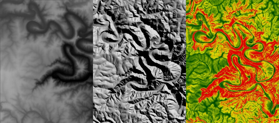
Recently, the increasing availability of digital elevation models has promoted the use of computer technology for the calculation and discrimination of terrain properties. DEM-derived data sets such as slope, aspect, hydro-graphical pattern and shaded relief are being increasingly exploited in terrain analysis. These morphometric parameters are not only less prone to human error but can be used to objectively and quantitatively compare terrain units (Dymond et al., 1995, Giles and Franklin, 1998).
The CGA is actively involved in a number of projects relating to terrain analyses. This includes land component mapping (Van Niekerk, 2010, Mashimbye et al., 2014), hydrological modelling, digital soil mapping, and visual impact assessments.
ADEDIRAN, A. O., PARCHARIDISB, I., POSCOLIERIC, M. & PAVLOPOULOSD, K. 2004. Computer-assisted discrimination of morphological units on north-central Crete (Greece) by applying multivariate statistics to local relief gradients. Geomorphology, 58, 357-370.
ARGIALAS, D. P. 1995. Towards structured-knowledge models for landform representation. Zeitschrift für Geomorfologie N.F, 101, 85-108.
DYMOND, J. R., DEROSE, R. C. & HARMSWORTH, G. R. 1995. Automated mapping of land components from digital elevation data. Earth Surface Processes and Landforms, 20, 131-137.
GILES, P. T. & FRANKLIN, S. E. 1998. An automated approach to the classification of the slope units using digital data. Geomorphology, 21, 251-264.
GRAFF, L. H. & USERY, E. L. 1993. Automated classification of generic terrain features in digital elevation models. Photogrammetric Engineering & Remote Sensing, 59, 1409-1417.
HENGL, T., GRUBER, S. & SHRESTHA, D. P. 2004. Reduction of errors in digital terrain parameters used in soil-landscape modelling. International Journal of Applied Earth Observation and Geoinformation, 5, 97-112.
IRVIN, B. J., VENTURA, S. J. & SLATER, B. K. 1997. Fuzzy and ISODATA classification of landform elements from digital terrain data in Pleasant Valley, Wisconsin. Geoderma, 77, 137-154.
MASHIMBYE, Z. E., DE CLERCQ, W. P. & VAN NIEKERK, A. 2014. An evaluation of digital elevation models (DEMs) for delineating land components. Geoderma, 213, 312-319.
SPEIGHT, J. G. 1977. Landform pattern description from aerial photographs. Photogrammetria, 32, 161-182.
VAN NIEKERK, A. 2010. A comparison of land unit delineation techniques for land evaluation in the Western Cape, South Africa. Land Use Policy, 27, 937.
