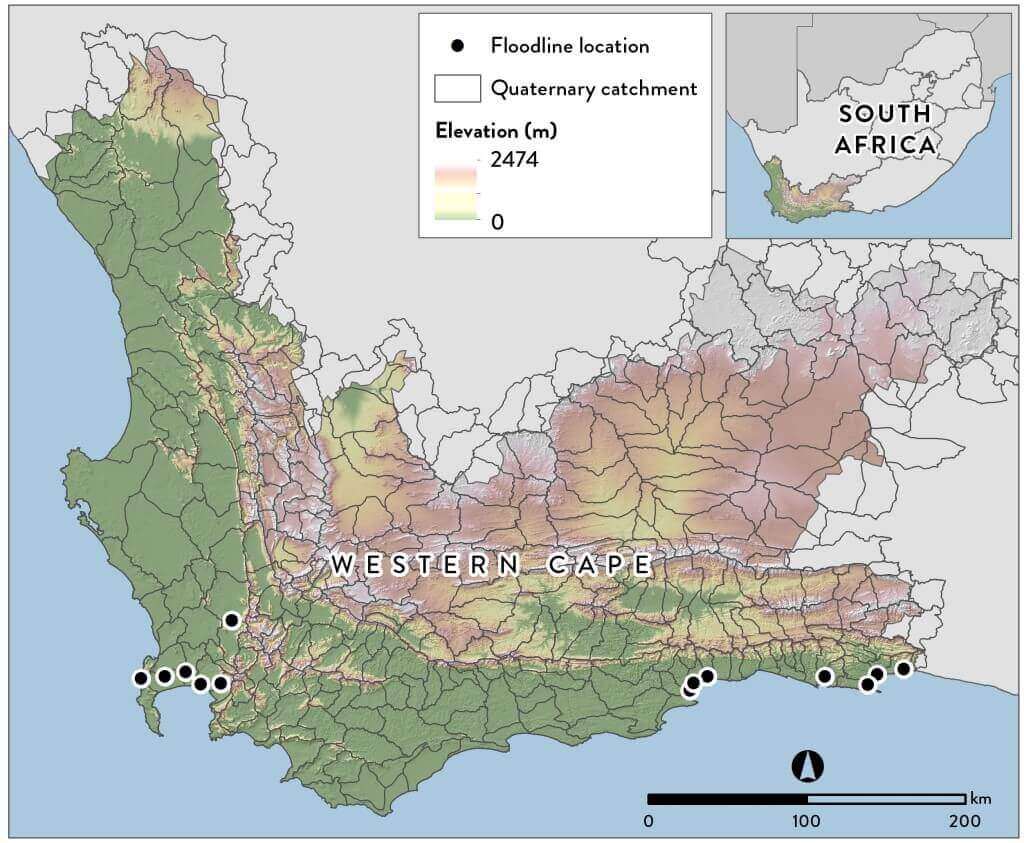
The CGA recently created a terrain-based Provincial Flood Hazard Index (FHI) of the Western Cape by using the Stellenbosch University digital elevation model (SUDEM). The overall purpose of the FHI is to improve:
- risk reductions measures
- flood preparedness
- spatial planning
The development process for this project was as follows:
- the SUDEM was prepared for hydrological modelling (i.e. mosaicking, removal of depressions) (Figure 1);
- a range of digital elevation model (DEM) derivatives, including HAND, the topographic wetness index, slope, aspect, catchment convexity, river convergence, etc. was generated;
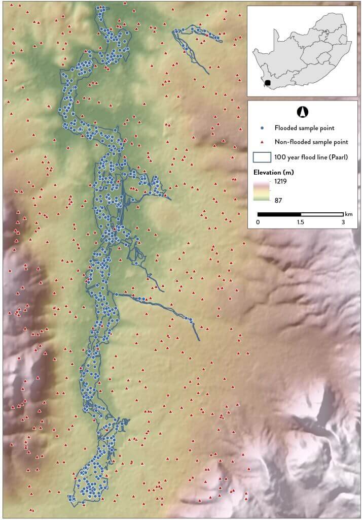
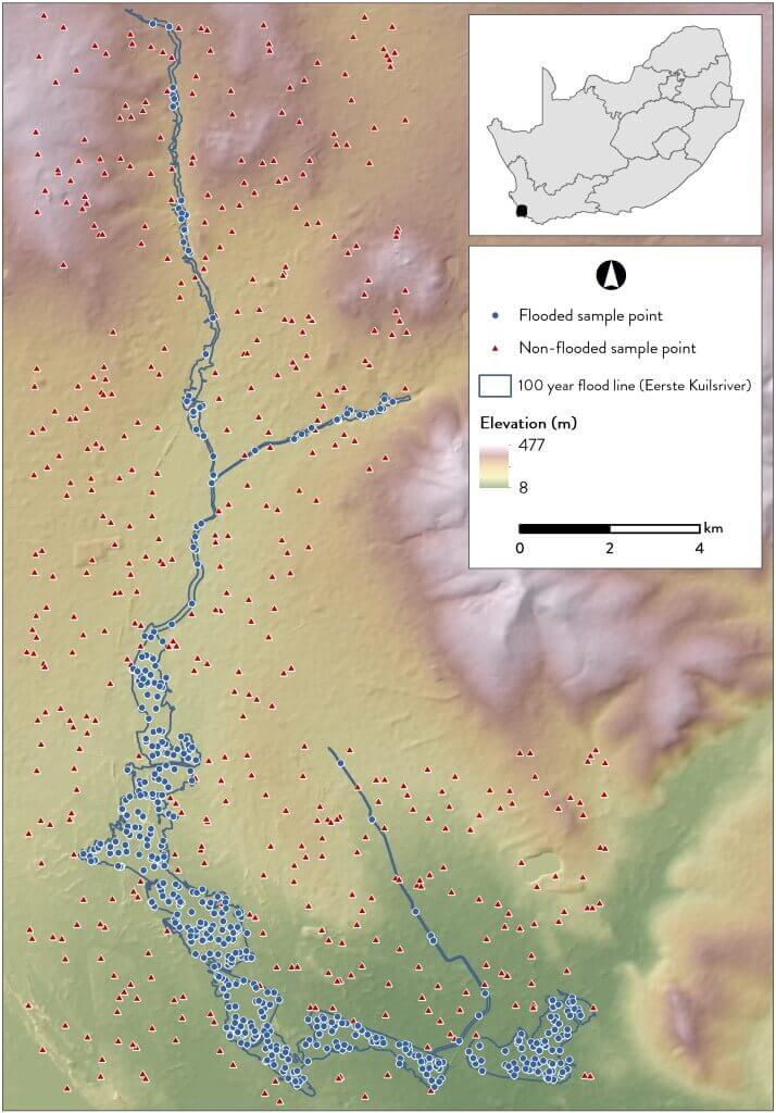
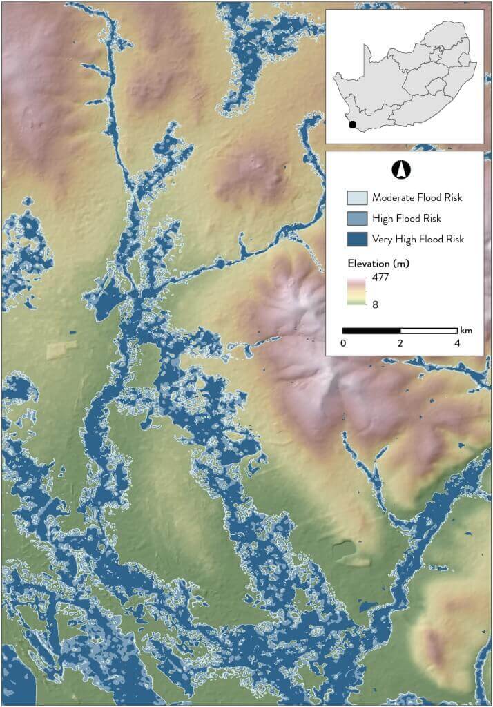
- all available floodline datasets, generated through hydrological modelling, were collated and used to generate points (locations) representing flood risk (Figures 2 and 3);
- the derivatives to existing floodline data were empirically compared using machine learning algorithms, and the most appropriate (accurate and representative) model was selected;
- the selected model was applied to the terrain derivatives of the province to generate a binary layer showing areas that are at risk to become inundated (flood-prone);
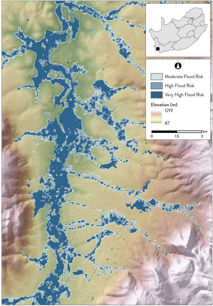
- a simple multi-criteria analysis was carried out to identify areas within the identified flood-prone areas that are most at risk (Figures 4 and 5); and
- a qualitative assessment of the output was conducted by comparing it to existing floodline data and doing visual interpretations of areas known to be flood-prone.
The identified areas do not reflect any probability of a flood occurring – it is simply a unit-less indicator of relative flood hazard and is meant to be used:
- as a scoping mechanism for identifying areas where hydraulic modelling is required; and
- to alert authorities to areas that are in danger.
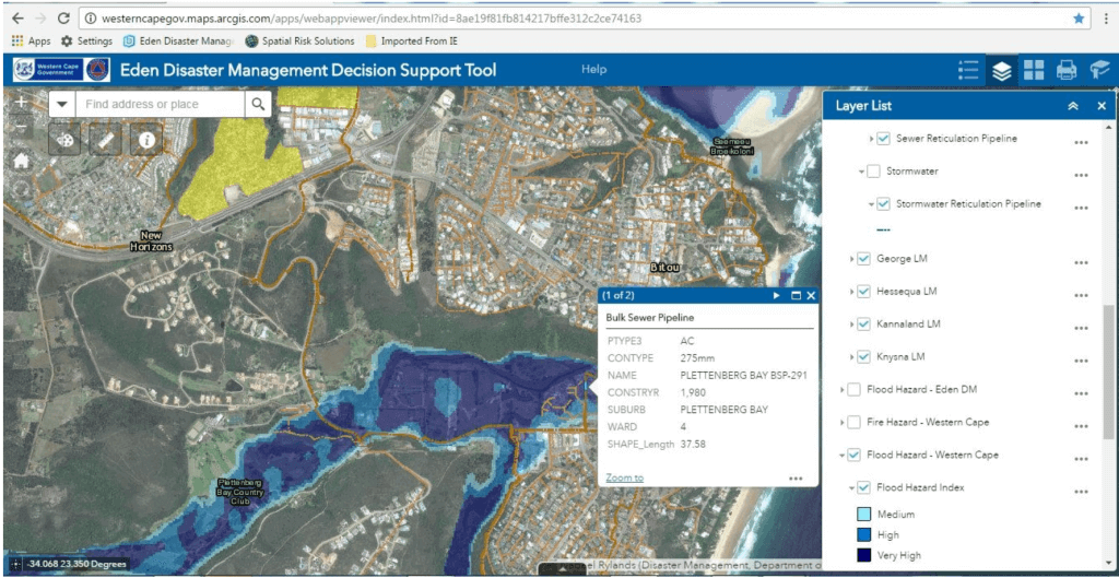
The FHI represents a first attempt at providing a consistent, province-wide spatial index of flood hazard. It was generated using a transparent, empirical approach that can easily be replicated using updated data (e.g. a higher resolution DEM and/or additional floodline maps) or be adapted for use in other areas (e.g. other provinces and districts). The FHI has been integrated with the existing Disaster Management Decision Support Tool (Figure 6) of the Provincial Government and has been made available to all relevant stakeholders.