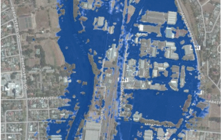
IWP pilot case: Paarl flood lines
In January 2017, the CGA provided a 2 m-resolution Stellenbosch University digital elevation model (SUDEM) (“Level 3 product”) of the Berg River and the surrounding area of Paarl for a pilot project modelling flood [...]

Farewell to GIS & Earth Observation Specialist Gerhard Myburgh
The CGA would like to say farewell to GIS & Earth Observation Specialist Gerhard Myburgh, who is leaving to take up a position as a GIS Programmer at Optron (PTY) Ltd. It [...]
On-line registration for our short courses is now open!
On-line registration for our short courses is now open. Click here to register and avoid disappointment*. Scheduled courses: Introduction to Geographical Information Systems (GIS) 08 May – 12 May 2017 & 16 October [...]
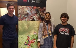
THE CGA WOULD LIKE TO CONGRATULATE RECENT GRADUATES
The CGA is proud to congratulate three of its staff members on their recent graduations. Jacques Vermeulen (right) obtained a National Diploma in Cartography and GIS from the Cape Peninsula University of Technology (CPUT), [...]
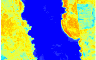
Changes in surface water area of Voëlvlei Dam from October 2016 to 22 March 2017
Changes in surface water area of Voëlvlei Dam near Gouda from October 2016 to 22 March 2017 as represented by a normalized difference moisture index (NDMI). The images, captured by the Sentinel-2 satellite, show [...]
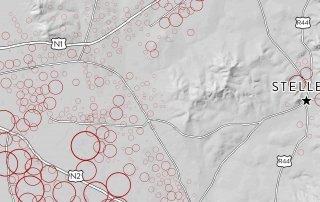
The CGA begins work on Phase 1 of land audit for Stellenbosch Municipality
In September 2016, Stellenbosch Municipality and the Centre for Geographical Analysis (CGA) at Stellenbosch University embarked on a collaborative effort to share GIS data and services. As part of this collaboration, a comprehensive [...]