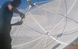
MESA receiving station is now operational
The CGA’s receiving station for MESA (Monitoring for Environment and Security in Africa), is now operational! In the first week of September, Motlotlegi Pilane, a representative of MESA, visited the CGA to [...]
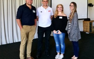
GISSA quarterly meeting
On the 20th of September five Students from Stellenbosch University presented their research and findings to the GIS community at the Western Cape GISSA quarterly meeting in Durbanville. Michael Johnson (MSc) – Extraction [...]
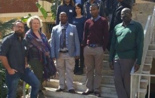
Introduction to GEOBIA, presented at CSIR, Pretoria
The CGA presented its Introduction to GEOBIA short course to the Environment (NRE) Ecosystems Earth Observation Research Group at the CSIR campus in Pretoria from 14-17 August. The course was presented as part [...]
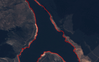
Satellite image time-series of main dams supplying Cape Town with water – Wemmershoek Dam
The final dam considered in our satellite time-series is the Wemmershoek Dam. Located between Franschhoek and Paarl in the Wemmershoek mountains, this earth-fill dam is one of the smaller dams supplying water to [...]
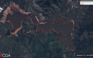
Satellite image time-series of main dams supplying Cape Town with water – Theewaterskloof Dam
The largest dam in the Western Cape, namely Theewaterskloof Dam, is the next dam being considered in our satellite time-series. Established in 1978, the earth-fill dam was constructed in the Riviersonderend River near [...]