See below a comparison of Sentinel 2 images of the fires affecting the Overberg area. On the left are images taken on the 22nd of December 2018 before the fires started, and on the right are images taken on the 6th of January, when the burnt area was estimated at 5600ha.
On the 8th of January, the Greater Overberg Fire Protection Association reported that the fire was 80% contained with an estimated burnt area of 8270ha.
The images are true colour, normalised difference vegetation index (NDVI), moisture index, and short wave infrared (SWIR).
To receive updated information on the progress of the containment of the fire follow the Greater Overberg FPA Facebook page.
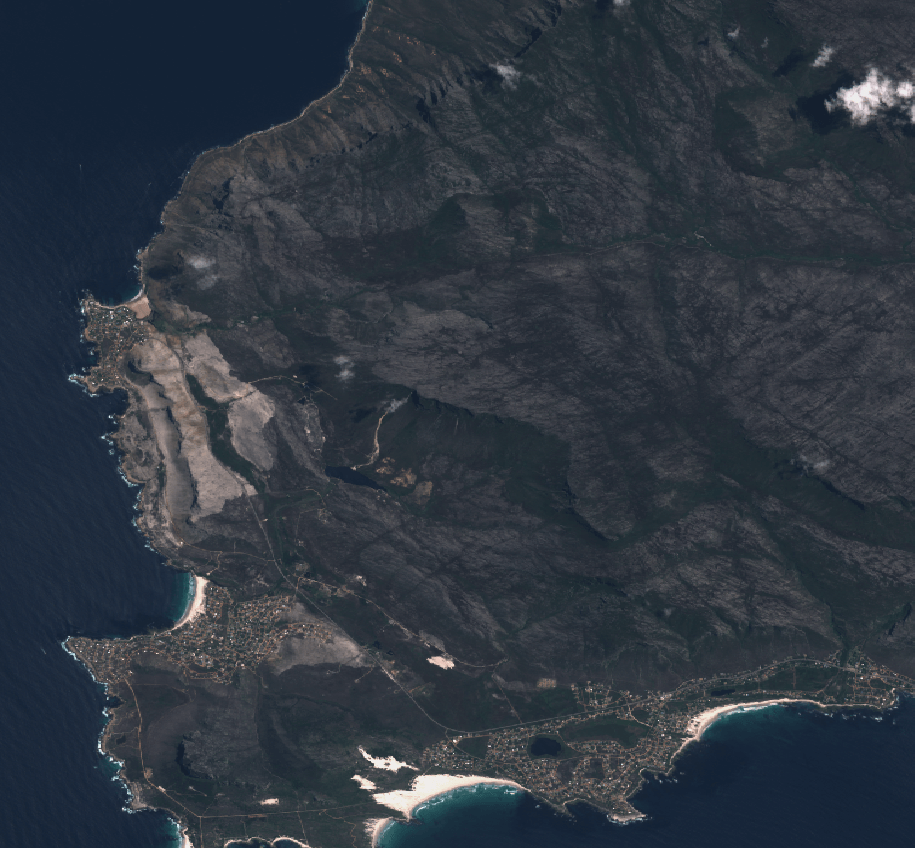
22 December 2018 True Colour
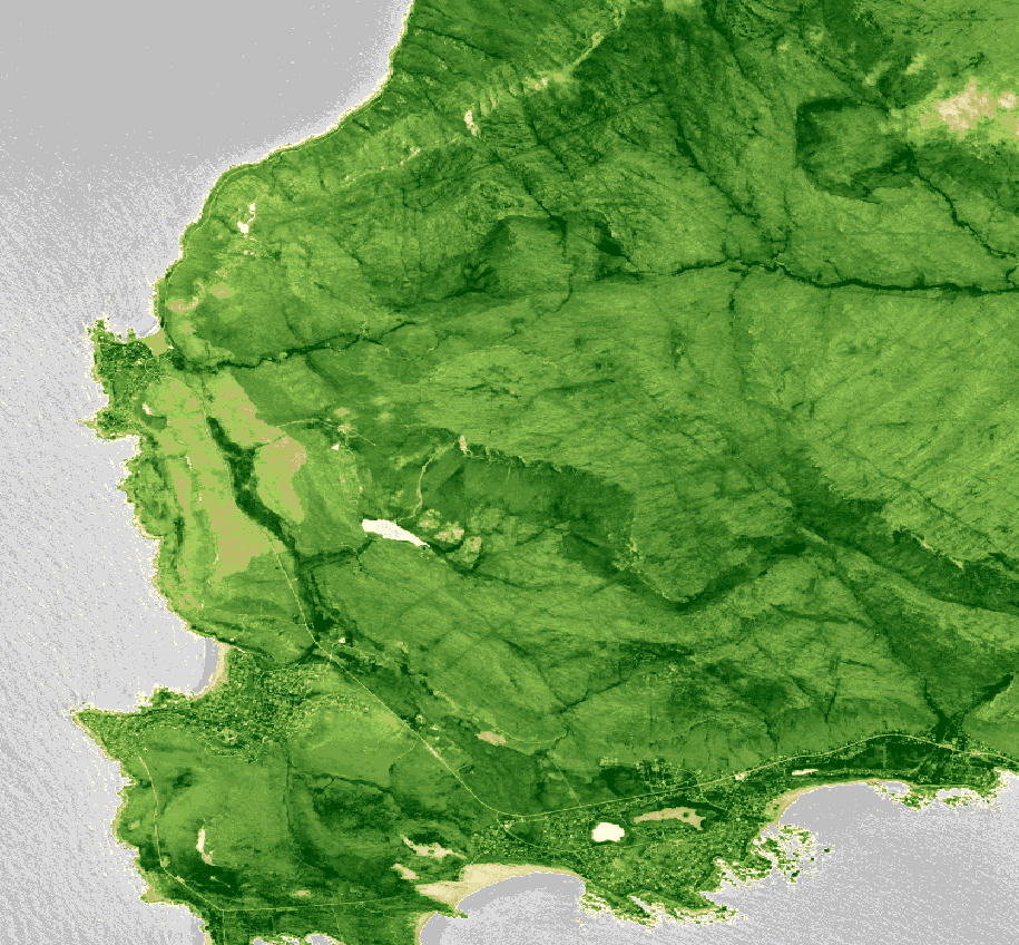
22 December 2018 NDVI
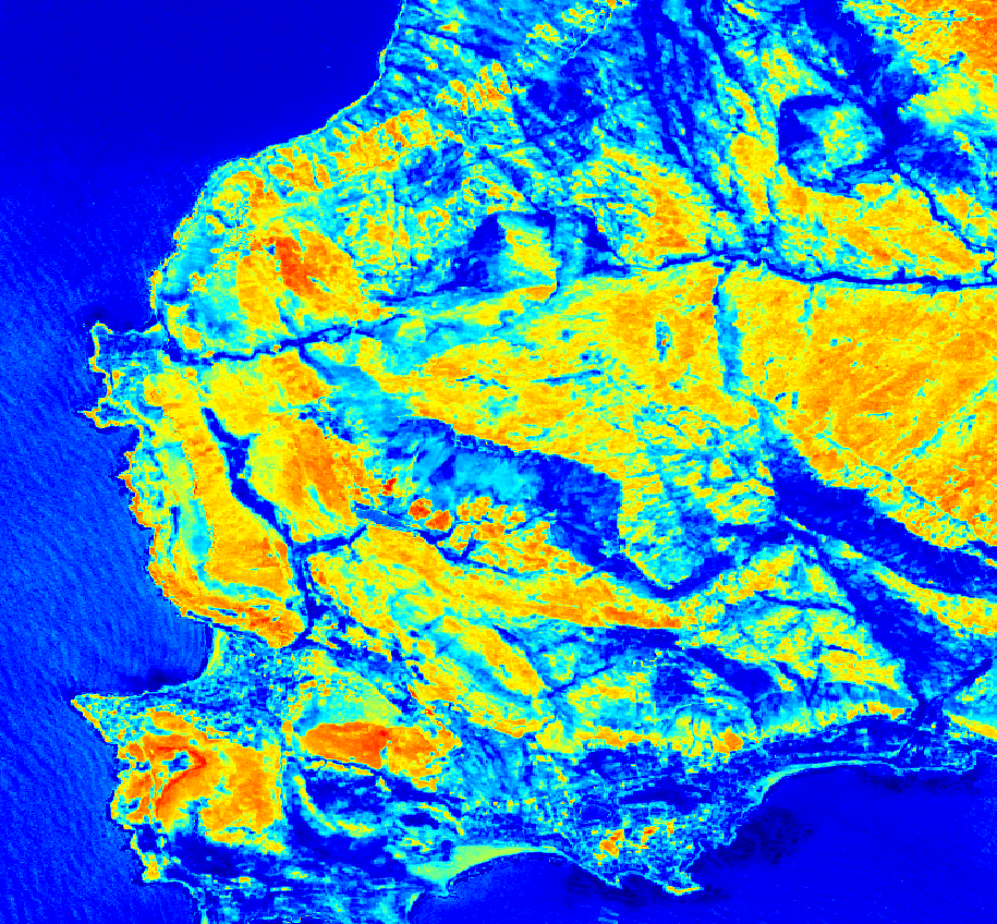
22 December 2018 Moisture index
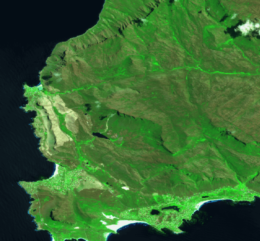
22 December 2018 SWIR
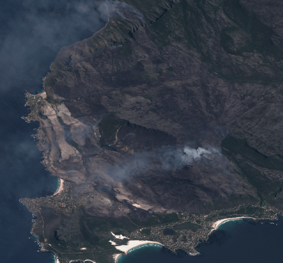
6 January 2019 True Colour
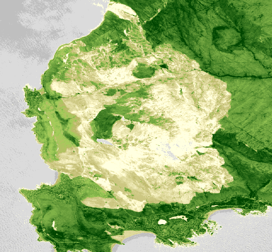
6 January 2019 NDVI
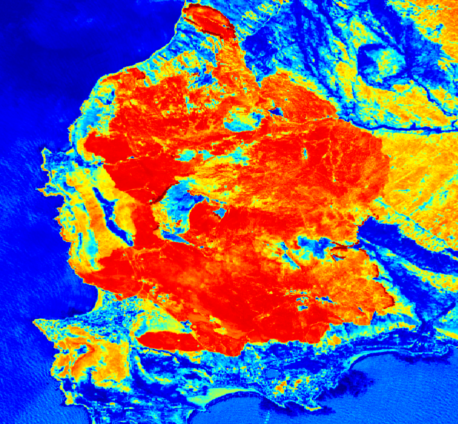
6 January 2019 Moisture index
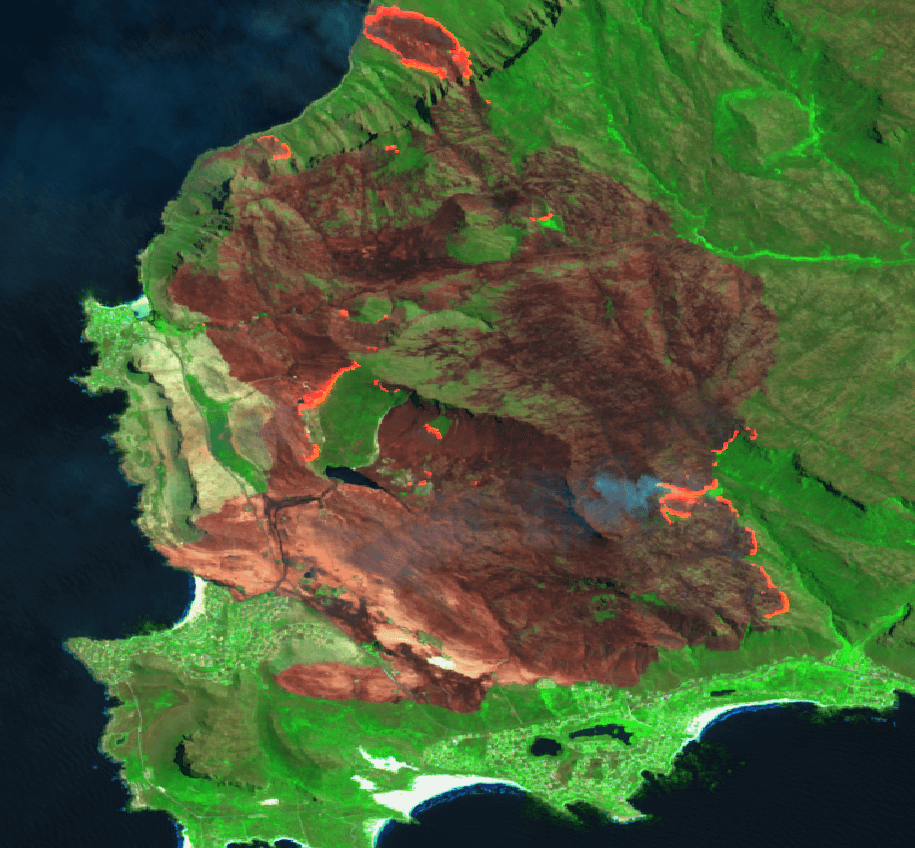
6 January 2019 SWIR
Images obtained via the EO Browser.
