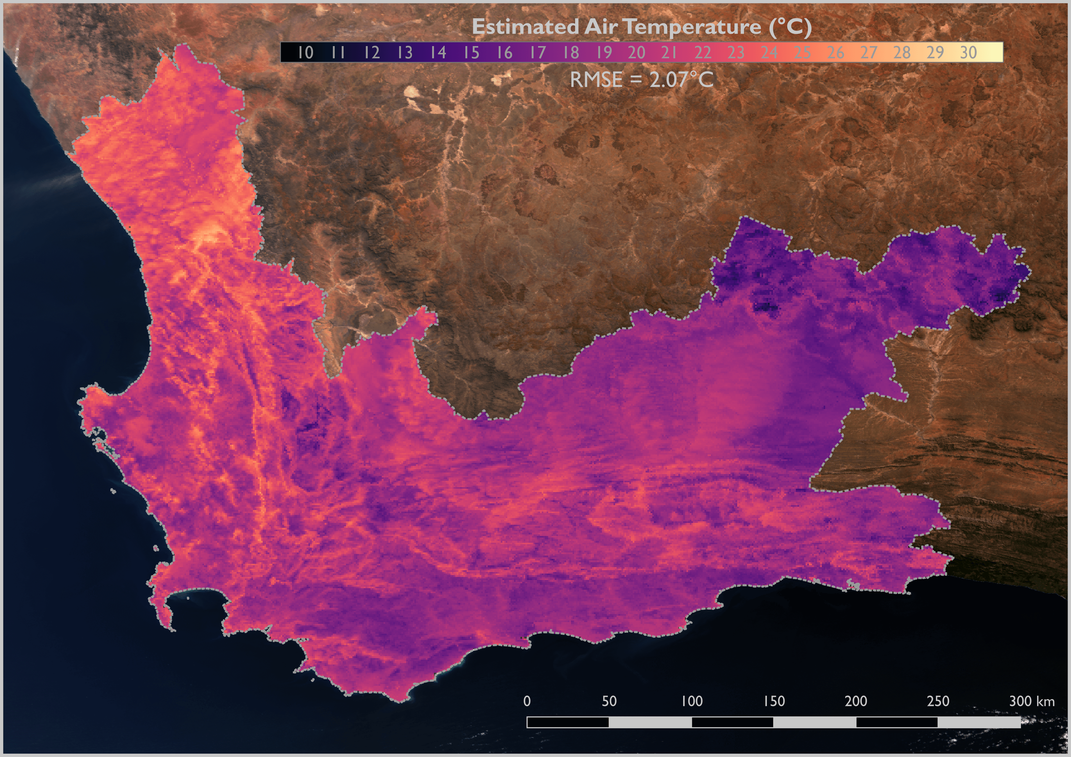
Air temperature varies across the Earth and as such it can be represented as temperature surface (map). Temperature surfaces provide critical information for applications relating to climate change adaptation and agricultural planning and management.
The generation of temperature surfaces usually involves interpolating temperature measurements taken at weather stations. Although the weather stations provide highly accurate temperature measurements, they are sparsely distributed because they are expensive to establish and maintain. This sparse distribution places an inherent limitation on the effectiveness and accuracy of interpolated temperature surfaces.
Satellite remote sensing provides an alternative approach to generating temperature surfaces. Thermal imagery provides complete coverage of the Earth’s surface and can effectively supplement (give geographical context to) measurements taken at sparse distributed weather stations. As an example, the figure above shows the result of combining the European Space Agency’s Sentinel-3 satellite’s land surface temperature (LST) with air temperature data measured at 144 weather stations across the Western Cape Province of South Africa. This air temperature surface is the result of post-graduate research carried out by Ockert Malan at Stellenbosch University.

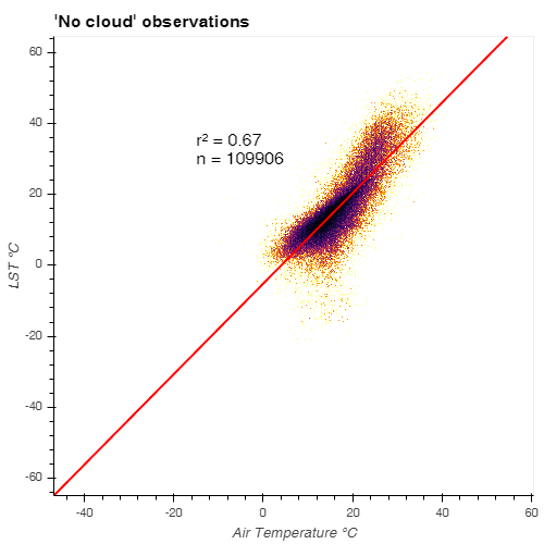
Ockert showed that Sentinel-3 LST and air temperature exhibited a strong, stable relationship across the Western Cape for all seasons and observation times. This relationship makes Sentinel-3 LST data particularly suited to air temperature modelling. Even simple univariate linear regression models (see graph above ) were capable of generating a 1 km resolution instantaneous air temperature surface of the Western Cape to an accuracy of roughly 2°C. His research also observed slight, but critical variations that could provide valuable insights for the implementation of more advanced, multivariate machine learning algorithms that will likely provide even more accurate results.

Originally starting off as an earth science student, Ockert quickly developed a passion for geographical information systems (GIS) and remote sensing and switched to the BSc programme in Geoinformatics, which he completed in 2017. This passion also lead to him being appointed at the CGA on a part-time basis as a data capturer. Ockert will be graduating with a BSc Honours in Geoinformatics this December. His honours research was funded by Winetech as part of the TerraClim project.
Ockert has since accepted a position at Geosmart, where he will continue to work closely with the CGA and TerraClim to help pursue the organisation’s aim of bringing space down to Earth.
