In January 2017, the CGA provided a 2 m-resolution Stellenbosch University digital elevation model (SUDEM) (“Level 3 product”) of the Berg River and the surrounding area of Paarl for a pilot project modelling flood lines in Paarl with an Integrated Water Platform approach.
“These flood lines are reliable due to the accuracy of the applied elevation map in combination with the use of the hydraulic dynamic model 3Di.” – (Nelen & Schuurmans, 2017)
The initial results of the pilot study indicate areas’ degree of vulnerability to flooding at various modelled river flows. Vulnerable areas of Paarl at higher modelled river flows include the industrial areas, train station and a number of residential areas, as shown in the images below. This project demonstrates the 2 m SUDEM’s capability of creating flood lines.
The Integrated Water Platform approach is feasible for, amongst others, creating information products that bridge the gap between technical information and public awareness.
For more information about the Integrated Water Project, please contact Anne Leskens of the Integrated Water Platform, or visit their website by clicking here.
Images are the result of a flood simulation, ran at 100 m3/s up to 2000 m3/s.
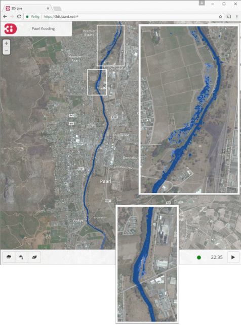
Simulated situation of the river flow at 200 m3/s.
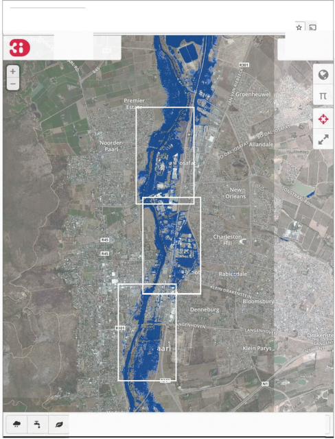
Simulated situation of the riverflow at 2000 m3/s.
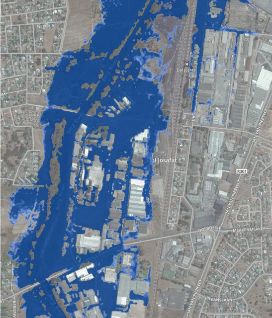
Simulated situation of the river-flow at 2000 m3/s, detail 1
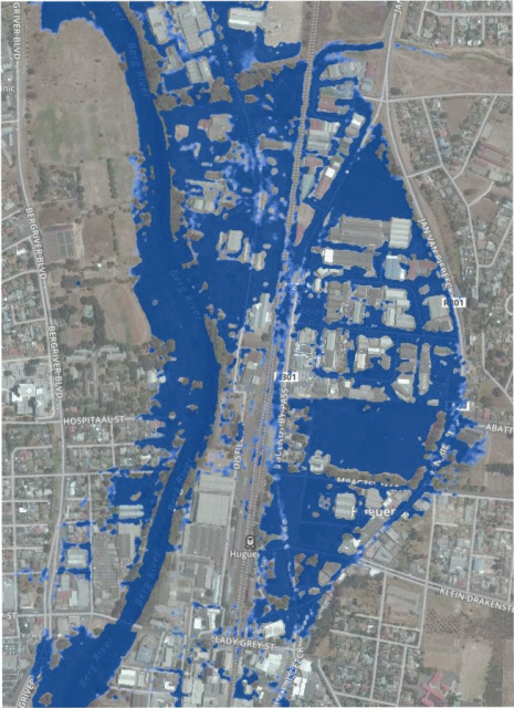
Simulated situation of the river-flow at 2000 m3/s, detail 2
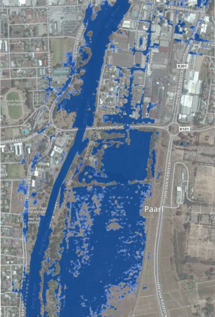
Simulated situation of the river-flow at 2000 m3/s, detail 3
