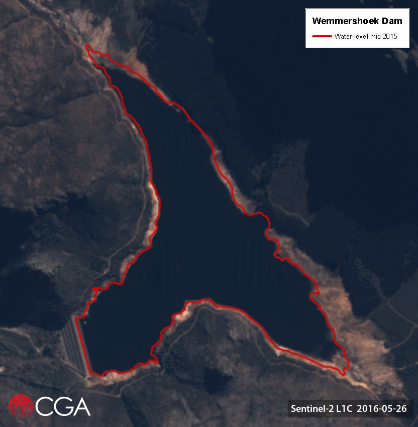
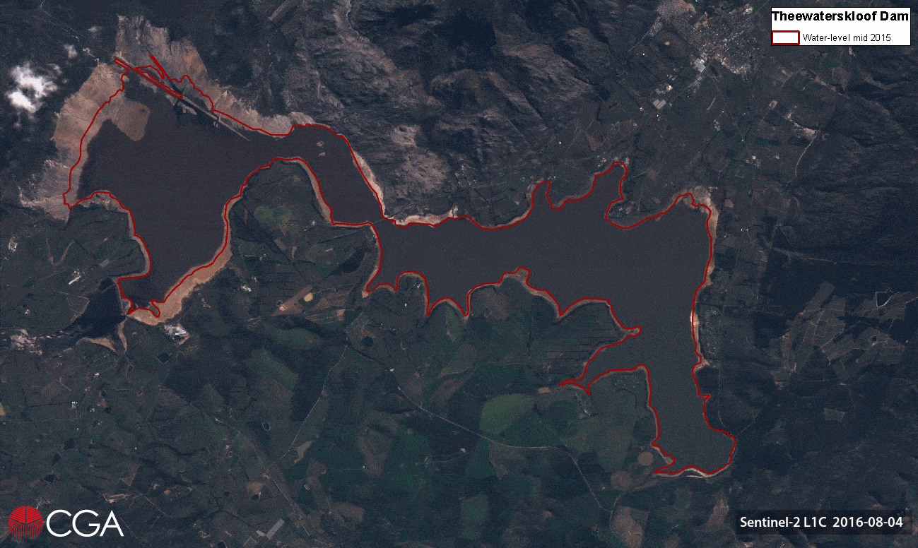
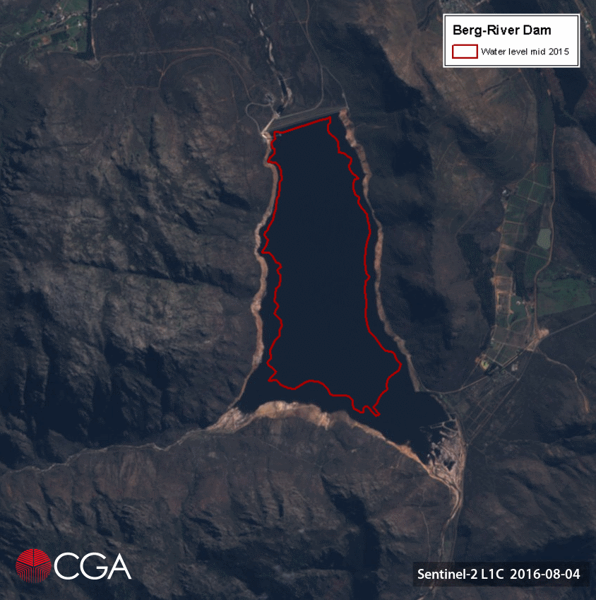
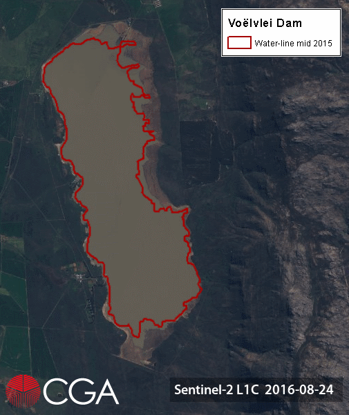
Satellite image time-series of main dams supplying Cape Town with water – Berg River Dam

The Berg River Dam, the most recently established large dam supplying Cape Town with water. The 68 m tall, concrete-face rockfill dam with a capacity of 130 million cubic metres makes up 14% of the water storage capacity in the Greater Cape Town Region. Planning of the dam began in 1989, with extensive social and environmental impact studies undertaken before ground [...]

Satellite image time-series of main dams supplying Cape Town with water – Berg River Dam2017-10-31T09:42:23+02:00

Satellite image time-series of main dams supplying Cape Town with water – Voëlvlei Dam

Second only to Theewaterskloof Dam in capacity, Voëlvlei is the third dam being considered in our satellite image time-series. Commissioned in 1952, the dam was constructed by impounding the natural Voëlvlei lake near Gouda, creating the first large water supply scheme in the Berg River catchment. Due to the relatively small size of the catchment, additional water is abstracted to the dam from [...]

Satellite image time-series of main dams supplying Cape Town with water – Voëlvlei Dam2017-10-31T09:43:53+02:00

Satellite image time-series of main dams supplying Cape Town with water – Steenbras Dams

In support of the efforts to alleviate the water shortage in the Cape Town region, the CGA is releasing a satellite image time-series of the main dams that supply the City of Cape Town and surrounds with potable water. The images show each dam’s highest water level in 2016, progressing through the summer [...]

Satellite image time-series of main dams supplying Cape Town with water – Steenbras Dams2017-10-31T09:57:53+02:00

Recent media releases

The CGA would like to share with you the recent media releases of the wide-scale modelling of water use and water availability with earth observation/satellite imagery project. The CGA in collaboration with Dr Caren Jarmain (independent consultant), GeoTerraImage and eLEAF of the Netherlands aims to update the existing estimations of the extent of [...]

Recent media releases2018-08-21T12:48:58+02:00

Launch of our newly redesigned website

The CGA is proud to announce the launch of our newly redesigned website, https://www0.sun.ac.za/cga/ The primary objective of this effort was focused on aesthetics, updating content, and simplifying navigation. Have a look at our updated services and products, portfolio, course calendar, and news articles. We would love to get feedback from users! [...]

Launch of our newly redesigned website2017-10-31T11:00:45+02:00

Introduction to GIS Short Course – May 2017

During the week of 8 -12 May 2017, the CGA presented another Introduction to GIS short course. 22 people attended, of which 14 chose the accredited version. The group included health care practitioners, statisticians, students and engineers, many of whom have never used a GIS before, and now feel confident to start applying [...]

Introduction to GIS Short Course – May 20172017-10-31T11:06:31+02:00

IWP pilot case: Paarl flood lines

In January 2017, the CGA provided a 2 m-resolution Stellenbosch University digital elevation model (SUDEM) (“Level 3 product”) of the Berg River and the surrounding area of Paarl for a pilot project modelling flood lines in Paarl with an Integrated Water Platform approach. “These flood lines are reliable due to the accuracy [...]

IWP pilot case: Paarl flood lines2017-10-31T11:14:02+02:00

Farewell to GIS & Earth Observation Specialist Gerhard Myburgh

The CGA would like to say farewell to GIS & Earth Observation Specialist Gerhard Myburgh, who is leaving to take up a position as a GIS Programmer at Optron (PTY) Ltd. It has been a great pleasure working with Gerhard and the CGA would like to thank him for his time and [...]

Farewell to GIS & Earth Observation Specialist Gerhard Myburgh2019-04-03T09:26:51+02:00

On-line registration for our short courses is now open!

  On-line registration for our short courses is now open.  Click here to register and avoid disappointment*. Scheduled courses: Introduction to Geographical Information Systems (GIS)  08 May – 12 May 2017 & 16 October – 20 October 2017 Introduction to Earth Observation (Remote Sensing) 14 August – 18 August 2017 & 13 November – 17 [...]

On-line registration for our short courses is now open!2017-10-31T11:23:37+02:00

THE CGA WOULD LIKE TO CONGRATULATE RECENT GRADUATES

The CGA is proud to congratulate three of its staff members on their recent graduations. Jacques Vermeulen (right) obtained a National Diploma in Cartography and GIS from the Cape Peninsula University of Technology (CPUT), while a Postgraduate Diploma in Civil Engineering: Geotechnical Engineering was conferred on Naajidah Lagardien (middle). Jascha Muller’s (left) research on the [...]

THE CGA WOULD LIKE TO CONGRATULATE RECENT GRADUATES2017-10-31T11:27:57+02:00
Go to Top