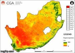
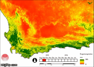
The CGA, in partnership with eLEAF ®, Agricultural Research Council, GeoTerra Image and several independent consultants, is currently carrying out research funded by the Water Research Commission (WRC) and the Department of Agriculture, Forestry and Fisheries (DAFF) to estimate the total water used by irrigated agriculture. Earth observation data (e.g. satellite imagery) is the primary source of data, with multitemporal evapotranspiration (ET) and rainfall data being the principal variables. Below are examples of the multitemporal ET composites that are being used.