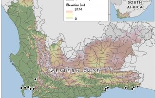
Development of a provincial flood-hazard index for the Western Cape Province
The CGA recently created a terrain-based Provincial Flood Hazard Index (FHI) of the Western Cape by using the Stellenbosch University digital elevation model (SUDEM). The overall purpose of the FHI is to improve: risk [...]
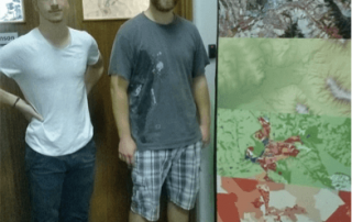
German exchange students
The CGA recently welcomed two earth observation students from the Friedrich Schiller University of Jena in Germany. Eric Krüger and Stefan Werner are both doing BSc degrees that require three months of vocational experience. [...]
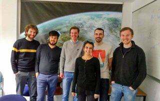
Welcome back Jascha
Jascha Muller returns to the CGA after a six month student exchange in Germany. On the 25th of February 2016 Jascha Muller, a remote sensing specialist at the CGA - Centre for Geographical Analysis, had the [...]
Calling all early career researchers
Equipping early career researchers with tools for evaluating ecosystem services which underpin food and water security Workshop Under the Researcher Links scheme offered within the Newton Fund, the British Council, in partnership with the [...]
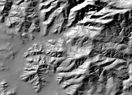
New version 5m SUDEM hillshade web mapping service available
The hillshade now includes Lesotho, Swaziland and extends into Namibia, Botswana, Zimbabwe and Mozambique so that it can be used for regional mapping purposes.
SUDEM processing procedure and the resulting products
The first step involves interpolation using spot heights and contours as input, which results in a 5m resolution DTM.